
Find Out All About Nuristan
Nuristan is one of the thirty-four provinces of Afghanistan. It was formed in 2001 from the northern parts of Laghman Province and Kunar Province. Nuristanis and Pashtuns make up the majority of the population of this province.
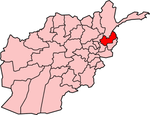
Located on the southern slopes of the Hindu Kush mountains in the northeastern part of the country, Nuristan spans the basins of the Alingâr, Pech, Landai Sin, and Kunar rivers. Its capital is Nuristan. It is bordered on the north by Badakhshan Province, on the west by Kapisa Province, on the south by Laghman and Kunar provinces, and on the east by Pakistan.
Until the 1890s, the region was known as Kafiristan (Persian: Land of the unbelievers) because of its inhabitants: the Nuristani, an ethnically distinctive people (numbering about 60,000) who practiced animism. The region was conquered by Emir Abdur Rahman Khan in 1895-96 and the Nuristani were forcibly converted to Islam. The region was renamed Nuristan, meaning Land of the Enlightened, a reflection of the "enlightening" of the pagan Nuristani by the "light" of Islam.
Nuristan is thought to have been the area of land where Alexander the Great camped with his men. Therefore there is much controversey of whether or not the Nuristani people are direct descendents of Alexander the Great or if they are the first real Aryan race.
Nuristan was the scene of some of the heaviest guerrilla fighting during the 1979-89 invasion and occupation of Afghanistan by Soviet forces. For a period of time during this era, the eastern area of Nuristan was a semi-autonomous region called the Islamic Revolutionary State of Afghanistan, or Dalwat. It was a Wahhibist Islamic state run by anti-Soviet warlord Maulvi Afzal and was recognized by Saudi Arabia and Pakistan. The Dalwat dissolved under Taliban rule.
Nuristan is one of the poorest and most remote provinces of Afghanistan. As of Summer 2006, no NGO's operate in Nuristan because of a poor security situation and lack of infrastructure. In response to a publicity campaign by Nuristan's governor, Tamim Nuristani, roads are being built between Nangarej to Mandol and Chapa Dara to Titan Dara [2]. Nuristani is also working on a direct road route to Laghman province, in order to not be so dependent on the road through restive Kunar province to the rest of Afghanistan.
Contents
|
Districts
- Bargi Matal District
- Kamdesh District
- Mandol District
- Nuristan District
- Wama District
- Waygal District
Politics
The current Governor of the province is Tamim Nuristani.
Security Situation
Nuristan is extremely poor and ridden with violent ethnic and economic conflicts. Different tribes in the province often engage in high-intensity fighting over economics and resources, especially water and timber [3]. The province's border with Pakistan makes it a historical transit point for insurgents, if not a central base for the Taliban.
Insurgent and criminal groups are also rife in Nuristan, including Lashkar-e-Toiba, Gulbuddin Hekmatyar's Hezb-e-Islami militia and a paramilitary led by Maulvi Afzal.
Trivia
Nuristan was the location of one of the missions in Hitman Silent Assassin (computer game).
The book and movie The Man Who Would Be King is based on Nuristan.